|
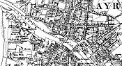
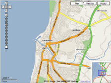
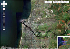
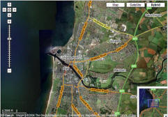
Google recently expanded its
mapping services to include the UK. In
addition to street maps and directions the
new service offers detailed satellite views
of cities and towns including Ayr. Shown
below are
three views of Ayr using the selections
in the top right corner of the map windows. All
three views allow zooming in and out of the map
using the controls provided in the top left side
of the map window. Map view is simply a street map.
Satellite view is an aerial image and Hybrid
combines both views. Give it a try at
Ayr on Google Maps UK . For a full
screen view go to
http://maps.google.co.uk/maps and enter Ayr in the search box. |